
To say David is fit is an understatement: he works out 7 days a week for a couple hours at a time. Needless to say, I didn't say no.
So when Al told me the tentative dates for a Shasta climb, David came onboard. Originally we were going to climb on June 24, but a week before, I dropped a heavy computer on my toe and had to postpone. As luck would have it, the weather wasn't good for a climb that weekend anyway, so Al ended up cancelling the trip.
Day One
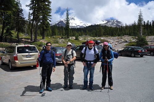
Rini met Al at his house, they picked up David, and met me at 6am. We took the long drive up to Shasta City, grabbed our gear at 5th Season, and drove to the Bunny Flat trailhead.
A bit of background, I originally attempted to summit Shasta two years ago, but turned around at the top of the Red Banks. Rini was with us on that trip, but didn't summit either.
In 2011, I went with Al to Shasta, but due to my bone bruise, only made it to Horse Camp before turning around. I ended up waiting in Al's van until they made it back, and yes, both he and the other person we went up with summited on that trip.
Needless to say, I had to finish the job. When we got to Horse Camp, I felt great, and had none of the pain that kept me sidelined the year before. We ate lunch there, and took care of whatever boot issues we were having at the time. David had a few hotspots, as did Al, who was breaking in new boots he'd purchased.
Once finished with lunch, we were on our way up the trail towards Lake Helen, and making pretty good time.
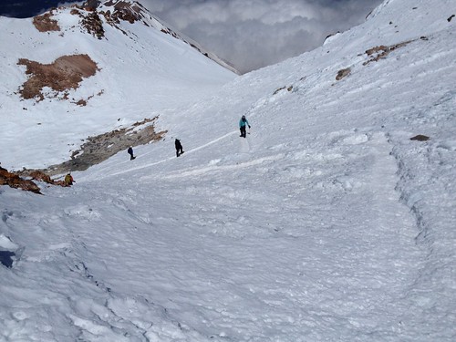
David was having some issues with his boots, saying his shins were hurting, so Al stopped to help him. Rini took a more difficult route up a snow bank, while the rest of us hiked up the switchbacks. As we were on our way up, people were glissading down the bank that Rini was hiking up. This was a guided group from 5th Season, who had gone up the day before.
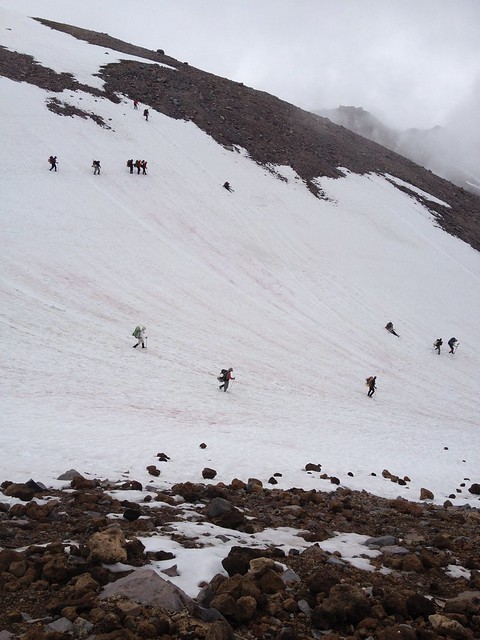
In my 2010 trip, we didn't have any snow to cross until Lake Helen, at 10,500 feet. This year, however, the snow started at the beginning of the switchbacks, making it a lot faster (but more difficult) to climb. Al was in the front, digging his crampons into the snow, while the rest of us followed in his footsteps, so to speak. This gave us a more solid footing.
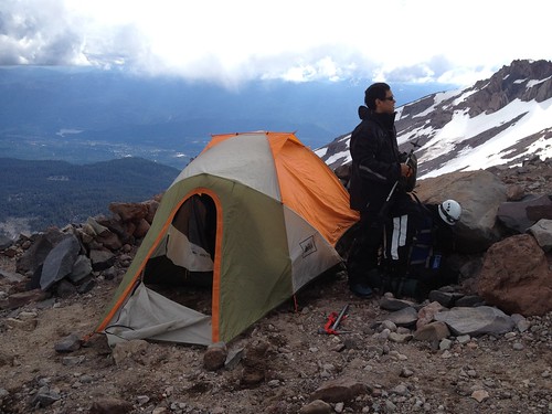
Once at Lake Helen, we set up our base camp.
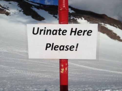
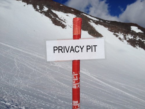
At some point over the past few years, the rangers on Shasta decided that there was too much human waste being spread around, so in addition to their requirement to pack solid waste out, they set up designated restroom areas. They even put up signs to direct people.
Liquid
Solid
Before boiling water for our dinner, Al wanted to go over climbing and glissading techniques before it got too late. We did this for about a half hour, and David started having elevation issues. His head started to hurt, and he was having a slight problem with expressing himself, both problem signs. As we made our dinner, David rested in the tent. As the sun was setting and the temperatures started to drop, I joined him. Al, of course, felt it necessary to document the event.

Day Two
I didn't sleep very soundly, which isn't an indicator of anything except the fact that I rarely sleep soundly when away from home. Al woke us up at 2am, and we dragged our sorry selves out of bed to gather our gear and have breakfast.
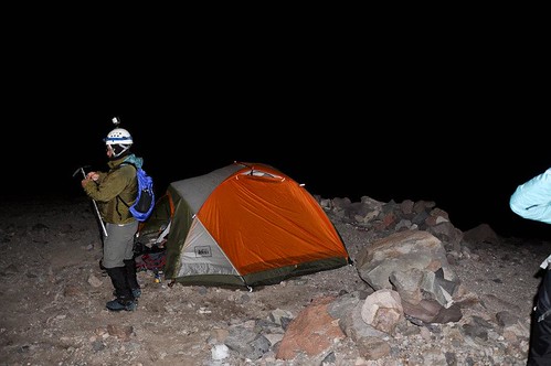
After much effort, at 4am we were off! At a snail's pace because, of course, it was steep AND we were at an elevation none of us were very acclimated to. Before we even started up, David was having similar problems to the night before. He finally decided to stay behind at base camp.
After about an hour, I started having trouble with the crampon attached to my left foot, which had detached from the boot. I reattached it (a chore that took 20 minutes at least), but a short time later, it happened again. I finally had to readjust the thing so it would stay put.
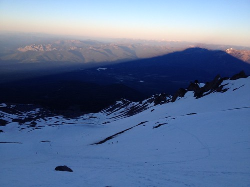
As the sun started to rise, the famous shadow that Mt. Shasta cast on the terrain was visible. It was quite a sight. In this picture, notice how small the climbers are below.
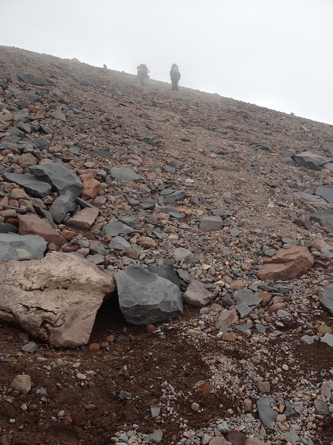
It got really steep closer to the Red Banks, so steep that we found it easier to just trace the steps of the climbers who had gone before us. They had created switchbacks in the snow and ice to the point where it almost (and I do mean almost) didn't feel like climbing anymore. It was a longer path, but beat heading straight up the mountain.

As we got to the top of the Red Banks, Rini sort of wandered off by herself, while Al and I hiked together. We crossed the snow bridge and took a 15-minute break right around 11:30. I took video from there with a friend's GoPro camera, but have been having difficulty getting it to YouTube for sharing purposes.
As we finished our snack and started to move on, Rini rounded the corner to where the snow bridge was. Al told her to take 20 as we kept going.
As with many other mountains, from the Avalanche Gulch route (and for that matter, from Shasta City), you can't see the peak. In fact, there are two false summits, the first of which took 20 or 30 minutes to get reach from the snow bridge. This was our first glimpse of Misery Hill.
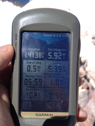
Misery Hill took 45 minutes to climb. It was another opportunity for a break, and for my GPS batteries to die. Wouldn't you know it? I had left my spare batteries back at base camp. After a good amount of begging, someone gave me a couple of AA's.
Summit Plateau had an interesting terrain, which reminded me of some science fiction film I'd seen at some point or another.
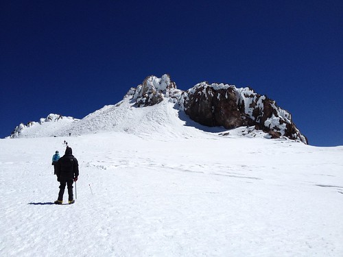
Rocks! Yes, Summit Plateau was the second false summit. What's interesting to me is that the trail to the summit had been shoveled to a nice path. We were met with the smiling faces of all the people who had previously been in front of us as we climbed.
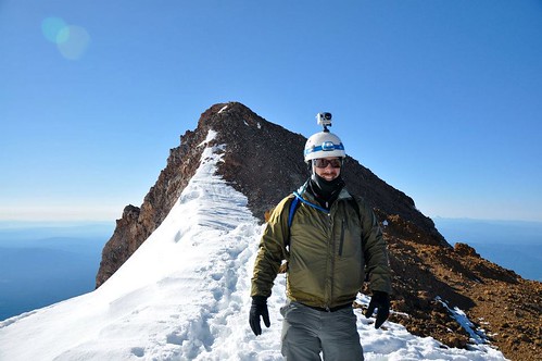
The top of the mountain was mostly rocks, which were difficult to climb. There was a couple taking pictures at the summit of the woman doing a plank on the guy's legs. I waited for them, and when they were done, I climbed the rocks. Just before noon, we were on the summit!
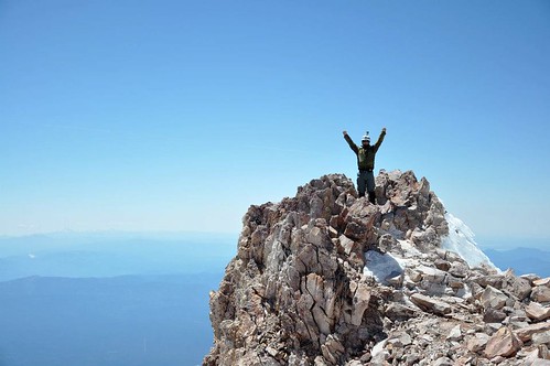
Two years after my first attempt, I finally made it to the summit. My second 14'er!
After signing the logbook, we headed back down. The original plan was to glissade from the bottom of Misery Hill, but it just wasn't safe enough to do so. We hiked back the same way we came up, and glissaded down starting at the end of the snow bridge.
45 minutes later, we were back at Lake Helen. David had watched us glissade some of the way, and told us that he had spent a good amount of time talking to the people in the tents next to us. That was a good thing, since we were probably gone 6 hours after he woke up.
We were able to glisade another half mile or so, which made the hike back a lot easier. David was still having boot issues, so Al let him use one of his poles. Rini went ahead of us at a pace probably twice that of what we had.
Once back at the trailhead, we drove back to Shasta City, dropped our equipment at 5th Season, then had dinner at the Black Bear Diner. The next morning, David told me all about how he can't wait to make another summit attempt. I just might tag along when the time comes.


