I've been a member of the Sacramento Hiking Meetup Group for quite a few years now. In fact, if it hadn't been for the group, I wouldn't have gotten the hiking experience I have now. It was with the group that I finished the Tahoe Rim Trail in 2007 and 2008, and learned about how rich in backcountry locations our area of Northern California is.
Since training for races and building up to the marathon the past few years, I haven't been hiking near as often. In fact, last year, I didn't do any hikes with the group at all. Imagine my surprise when I got an email from Meetup stating that not only was Mike Brinkley, a longtime member of the group, had become organizer, but that he was organizing a Mt. Shasta climb! I signed up for it that day and emailed Mike, telling him I felt the group couldn't be in better hands.
Mike takes great care in making sure the people in the back of the group make it home safely, whether he's an organizer or not, and in my early days in the group, that was me all the way. Sure, I'd lost weight, and was in the process of getting into shape, but I certainly had a long way to go. This meant spending a lot of time in the back, and also meant, spending a good amount of time hiking with Mike.
That was then, however, and this is now. As luck would have it, I'm in better shape now, and there was a Shasta climb to prepare for. In getting ready for Shasta, I repeated one of the TRT hikes, and climbed to a few peaks with the group ahead of time for conditioning purposes.
Day 1: Helen Lake
The first order of business was obtaining the gear. While I've done quite a bit of hiking, I've rarely encountered winter conditions. My boots can't take crampons and really aren't designed for that sort of terrain. Most of the others in our group were in the same boat, so we stopped at Fifth Season in Shasta City to pick up boots, crampons, ice axes, and helmets. From there, we went to eat breakfast at the Black Bear.
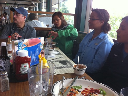
Brian, Ingrid, Holley, and Rini at the Black Bear Diner
The Black Bear is known for its ample portion sizes. Thanks to California law, they're required to provide nutritional information about their food; that doesn't mean they have to like it. In the nutritional guide, it talks about their reputation, and how some people feel their portions are too large and should therefore bring home leftovers. Right next to the normal statement, "Based on a 2000 calorie per day diet" is the listing for their dinners, each of which weigh at more than 2000 calories apiece.
I opted for the 7-grain pancakes, lots of good carbs in preparation for the weekend ahead.

It really was work trying to get down just the pancakes alone. I also managed a piece of bacon and the egg, but didn't touch the sausage.
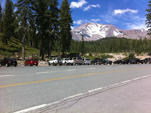
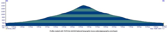
After breakfast, we drove the 20 miles or so to the trailhead, got our permits, geared up, and started off. To start, the trail wasn't all that bad, mostly flat, certainly nothing strenuous.

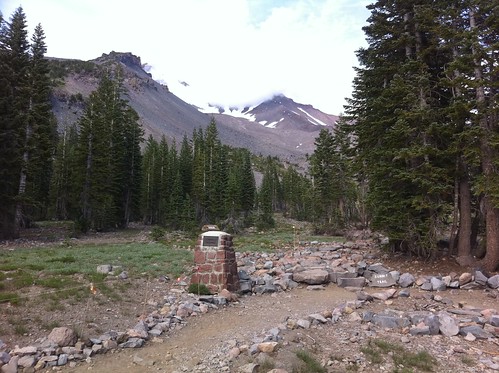
I'm sure this was by design, for the first 1.7 miles were to a cabin that's owned and maintained by the Sierra Club, at a location known as Horse Camp. Camping in the cabin is against the rules, but it can be used in winter months as a shelter against the elements. A resident caretaker has a tent nearby and is there to maintain it, as well as act as an informational guide to visitors. A $2 fee is requested if the facilities are used, including a natural spring for refilling water, and a non-chemical, natural bathroom.

If I had any complaints about the cabin, it's that it was too close to the trailhead. It did, however, give us a chance to take care of any developing blisters that could be a problem (I had none) and get some guaranteed-fresh water for the trip up the mountain.
Directly behind the cabin is a 1-mile stretch of stones known as Olberman's Causeway. The first caretaker of the cabin decided that it would be better to have a walkway to protect the surrounding natural environment, so he built it out of large stones. There are now signs that tell visitors to stay on the causeway, rather than walk on the ground itself.
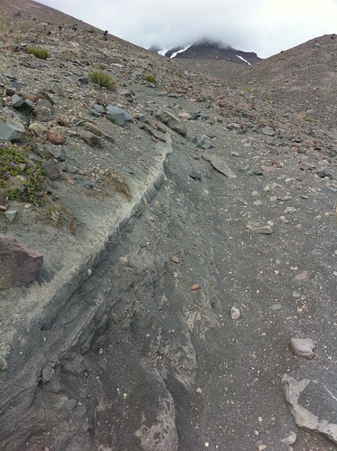
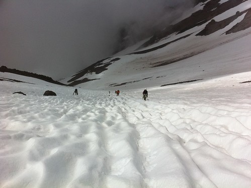
There was a small incline, but not too bad; however, at the end of the causeway, we were reminded of where we are, and why: it was time to climb.

That image is actually looking back in the direction we came from, about 3/4 of a mile from the edge of the causeway. The higher we got, the steeper the trail got, and the less the trail builders felt like building switchbacks. It was almost as if they decided that hey, if they were working that hard building the trail, the people hiking the trail should work just as hard getting to the same place.
The temperature was dropping rapidly as well. I also made the mistake of hiking with the same shirt I'd worn up to the mountain, a cotton, Avenue of the Giants Marathon shirt that was comfortable, but nonetheless not intended for doing strenuous exercise in. My sweat-covered back did nothing but get cold in the drenched shirt, so I finally had to change into a long sleeve compression. This was more like it, so it was time to get into gear and continue the climb.
At the top of the crest, it appeared we had made it to Helen Lake, our Day 1 destination. There were a few tents, and a large group of people gathered. Come to find out, this wasn't our destination, which would turn out to be another few thousand feet up. I took the opportunity to put on some gloves and a jacket.

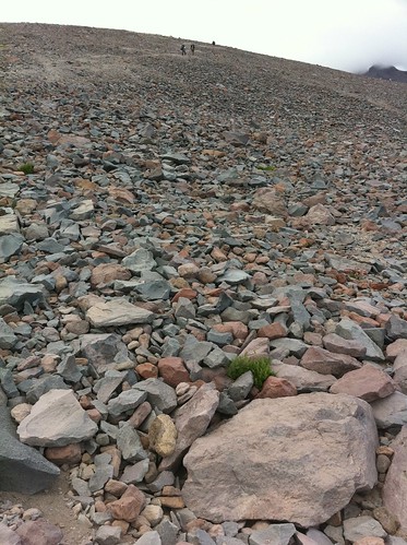
Between that crest and the ascent to Helen Lake was a talus field. With the sun now completely down and darkness rapidly ascending, I put on my headlamp, but wasn't able to find a trail. I knew where we were headed, and Ingrid wasn't far ahead, so I basically followed her to the top.
We finally reached Helen Lake at 9pm. I set up my camp as quickly as I could, ate dinner, and got to bed in order to rest up for the coming day.
Day 2: To Infinity And Beyond!
Before we all gathered for breakfast the day before, Mike made mention that we would be leaving at first light. At 2:30 in the morning, I heard some people leaving for the summit, but my head was pounding, so I went back to bed. At 6, I heard Ingrid asking if anyone was getting up, but it sounded to me as if she was asking for Jello. Again, I went back to sleep.
At 7, I stumbled out of my sleeping bag to find a place to go to the bathroom.

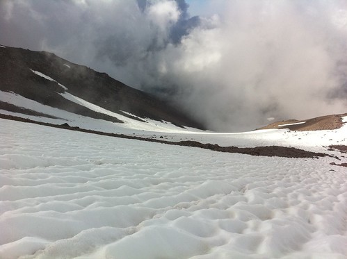
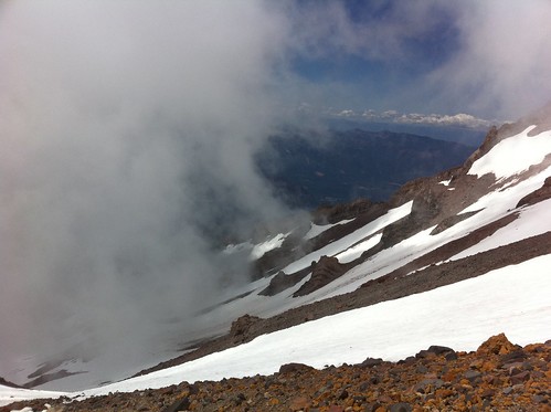
The fog rolling across camp was beautiful! I do wish I could have seen the camp in the daylight the night before, but that's alright. I took a few minutes to look around before using the facilities.

Once I'd done that, I went off to find my fortune, which provided me the opportunity to use a Wag Bag. If you haven't heard of it, it's a method of going poop without leaving the poop behind. That's right, you pack it out. The version I was carrying came from Mt. Whitney, and the idea is you poop into a bag filled with scented kitty litter, tie it off, then put it into a second, thicker ziplock bag to hold in the freshness. You then carry it with you and leave it in a recepticle at the trailhead.
So off I went. Every time I bent over, my head would start to pound, and I was starting to worry that at approximately 10,000 feet, I'd have to give up due to elevation sickness. I told Mike about it, but went on with the thought that if things got too bad, I'd just head back. I packed my daypack with the layers I expected to use, as well as some food.
As we were getting ready, a ranger gave us a quick tutorial on glissading and self arrest. We put on the crampons, mounted our helmets, and with ice axe in hand, I was ready to start the ascent, getting started almost right at 9am.

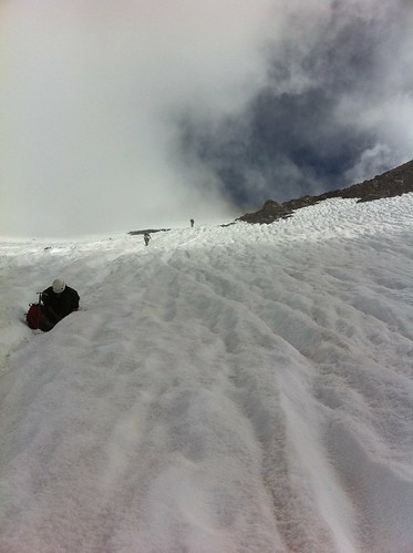
This was completely different than the day before. The clouds would roll in and out, going back and forth between warm, direct sunlight, causing us to remove layers, and cold fogginess, causing us to put them back on. This made the already slow going even slower.

Even though it was annoying having to remove our layers and put them back on repeatedly, there was no denying the beauty of our surroundings. It even made climbing a little less annoying.

With all the climbing, a few people had leg cramps. Here, Robyn (who met us at camp) was sitting down, tending to blisters, and resting from her cramps.
To show how slow going it was, here's a quick video I took with my iPhone.
As we reached the bottom of the Red Bank, we hit the steepest portion of the snow. It was almost twice as steep as it was before, to the point where the only way to climb was to pick my axe in, pull myself up, rinse and repeat. We did this for about a half hour, when I looked at my watch and saw that it was 2pm.
I quickly calculated that we probably wouldn't make it home at a decent hour unless we turned around. I told Mike what time it was, and he immediately knew what I was getting at. We started discussing the situation. A few people wanted to summit anyway, so they went ahead. Mike, Brian, myself, Ingrid, and Rini all felt we should turn around. We decided to at least climb to the top of Red Bank, rest a moment, then turn around.
Once at the top, it was only a few minutes before we saw the other members of our group heading back down from the top. One person was actually running down the last hill! There was just not enough time for the rest of us to summit and come back down. We turned around, positive in that we didn't turn around due to not physically being able to summit, we turned around because of time.
The last steep portion was quite daunting to go down. We sat for a very long time just staring at it, wondering if we should even attempt it. Earlier, another group was heading down as we were coming up, but they weren't glissading as we were considering; they were climbing down with crampons and a rope.
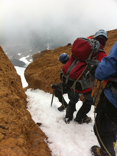
The steep portion wasn't really all that long. You can see in the picture that the chute going down the mountain actually turned through some rocks. The rocks weren't so much the concern, the concern was slamming into them headfirst!
We looked for a while longer when the guy who had run down the hill at the top decided to go for it and just slid right down. Brian went next, followed by Ingrid, so I decided to follow. I was pretty scared, so I kept using the axe to stop myself as I went down. When I passed Brian and Ingrid, they weren't glissading, but climbing down backwards using their axes and crampons as they went. I decided to keep trying however slowly and glissade past the most steep portion.
Once at the bottom, some people we had talked to on the way up were at the bottom of the steeper portion, while two other members of their group were at the top. They were trying to get the attention of the other members, wanting them to hurry up so they could get to the bottom. As Mike started coming down the chute, Brian came down and joined me where I had stopped.
The two guys from the other group started heading up, and it was obvious they were in phenomenal shape. They were ascending the steep part of the chute 3 times faster than we had been earlier! Amazing.
Brian and I were waiting for Ingrid and Mike to come down the chute, but it wasn't happening. 20, 30, 40 minutes passed with nary a word, so I shouted up to Mike, asking what was going on. This is where luck and coincidence sort of conspired together.
Mike shouted down, saying Ingrid was in bad shape. She had a touch of hypothermia, her fingers were turning purple, and she couldn't stop shivering. As luck would have it, the two guys who had headed back up towards the rest of their team were volunteer first responders and could immediately tend to Ingrid! They worked on her for another hour or so to get her warm, and told Mike they would accompany her back down to Helen Lake.
Before Mike came down, a person came down the chute, saying, "Hi!" as she passed: it was Holley! She went by so fast she couldn't say anything else, and we saw her slide on down the mountain.
Mike came to us, told us Ingrid's situation, and satisfied that the first responders would be with her, we went down with Mike in the lead and Brian behind me.
This was an amusement ride like no other. While climbing up from Helen Lake took 6 to 8 hours, sliding down took less than an hour. There was little physical effort on my part, because gravity took over. The chute was already well defined from all the people sliding down prior, so all that was required now was to slow myself down if necessary, and enjoy the ride.
After about 20 minutes, I could see the camp. It still looked a long way away, and it really was. 20 minutes after that, I was at the bottom, had an icy rear end, cold fingers, but adrenaline flowing. Without a doubt, I didn't feel cold.
We went to our tents, and immediately I changed out of my cold, wet clothes and into the dry. As I started taking down camp, Ingrid and the first responders arrived. They told Mike that she needed to get into a sleeping bag for about a half hour, get warm liquids, and basically get her body warm.
Meanwhile, I kept tearing down my camp. It still took a long time, and by the time we were finished, it was 8pm and again, darkness was looming. By the time my pack was loaded, I had to wear my headlamp to see.
We came back down the way Ingrid and I had come up, a trail that led to the base of the talus. In the dark, we were able to follow the trail flags to a snow field. On the other side of the snow field was the trail that we had taken on the way up, which was different than the one we were on now.
At the edge of the snow field, we found the footprints of the people who had gone ahead of us, which led us to the trail. On the way down, we ran into Brian, Ingrid, and Rini, who had gone down ahead of us. Rini stayed with us, while Brian and Ingrid went ahead.
We took a break at the cabin and used the bathroom there once again. Once our Nalgene bottles were full at the spring, we went the rest of the way down to the trailhead. I got to my car at 10pm.
The drive back home was uneventful. I was exhausted and ended up sleeping at a rest stop for a few hours. Once home, I went to bed and slept until the afternoon.
Was it a great trip? Indeed, it was. Did I summit? Nope. Do I care? Not in the least bit. The mountain will be there, and there's already talk of organizing another trip earlier in the summer of 2011.
Visit my Flickr stream for the rest of the photos that didn't get put into the trip report, as well as view a Google Earth flyby of the climb. Enjoy!